How to calculate shipping emissions using vessel tracking
In this guide we'll explore calculating shipping emissions with vessel tracking (AIS tracking) used to calculate the distance for better results compared to other, less precise distance calculation methods.
Prerequisites
In order to proceed with the steps provided you need
- A Lune API key
- Vessel tracking enabled in your Lune organisation
- cURL and jq installed (or be willing to adapt the procedure to your tools)
Gathering the data
A request template containing information needed to calculate shipping emissions using vessel tracking:
You need to adapt the template to your situation (you may need to read the API reference to see what's permitted):
Change
shipmentto what you're actually shipping.Change the
routeto reflect where you're shipping from and to.Change
vessel_imo_numberto match your vessel and change thedeparture_onandarrival_ondates to match your shipment dates.Make sure
departure_ondate is within the past 3 months: vessel tracking is only available for departures within the past 3 months.
Optionally:
You can replace
vessel_imo_numberwithvessel_nameif you don't know the vessel's IMO number but know its name.You can provide the vessel's MMSI number as
mmsi_numberinsidevessel_tracking– this makes it more likely that we can identify the right vessel.vessel_trackingwould then look like{ "departure_on": "2023-12-27", "arrival_on": "2024-01-29", "mmsi_number": "636023063" }
{
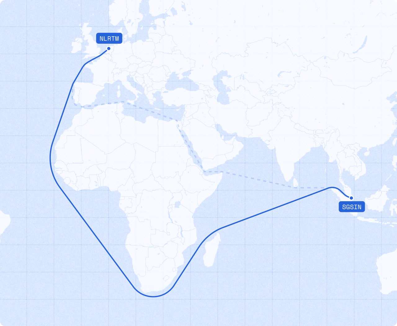
"route": {
"source": {"locode": "SGSIN"},
"destination": {"locode": "USNYC"}
},
"method": {
"vessel_type": "container_ship",
"vessel_tracking": {
"departure_on": "2023-12-27",
"arrival_on": "2024-01-29"
},
"vessel_imo_number": "9260419"
},
"shipment": {
"containers": "2"
}
}Making the request
Once you have the right data send it to the Lune API like so:
curl 'https://api.lune.co/v1/estimates/shipping' \
  -H "Authorization: Bearer $API_KEY" \
  -H 'Content-Type: application/json' \
  -X POST \
  -d '{
    "route": {
        "source": {"locode": "SGSIN"},
        "destination": {"locode": "USNYC"}
    },
    "method": {
        "vessel_tracking": {
            "departure_on": "2023-12-27",
            "arrival_on": "2024-01-29"
        },
        "vessel_imo_number": "9260419"
    },
    "shipment": {
        "containers": "2"
    }
}'
Interpreting the response
If everything goes well you should see a response like below. The relevant parts are:
- A confirmation that
vessel_trackingdistance calculation method has been used - The distance
- The route the vessel took
- The estimated emissions (
mass)
{
  "distance_calculation_method": "vessel_tracking",
  "distance": {
    "unit": "km",
    "amount": "24453.17"
  },
  "adjusted_distance": {
    "unit": "km",
    "amount": "24453.17"
  },
  "mass": {
    "unit": "t",
    "amount": "4.328158"
  },
  "route": {
    "legs": [
      {
        "distance": {
          "unit": "km",
          "amount": "0.85"
        },
        "location": {
          "label": null,
          "coordinates": {
            "lat": 1.273705,
            "lon": 103.75491333333333
          }
        },
        "adjusted_distance": {
          "unit": "km",
          "amount": "0.85"
        }
      },
      {
        "distance": {
          "unit": "km",
          "amount": "0.3"
        },
        "location": {
          "label": null,
          "coordinates": {
            "lat": 1.2764133333333334,
            "lon": 103.754505
          }
        },
        "adjusted_distance": {
          "unit": "km",
          "amount": "0.3"
        }
      },
      ...
      {
        "distance": {
          "unit": "km",
          "amount": "12.97"
        },
        "location": {
          "label": null,
          "coordinates": {
            "lat": 40.643213333333335,
            "lon": -74.057125
          }
        },
        "adjusted_distance": {
          "unit": "km",
          "amount": "12.97"
        }
      },
      {
        "distance": {
          "unit": "km",
          "amount": "0.72"
        },
        "location": {
          "label": null,
          "coordinates": {
            "lat": 40.64749833333333,
            "lon": -74.06345
          }
        },
        "adjusted_distance": {
          "unit": "km",
          "amount": "0.72"
        }
      }
    ],
    "source": {
      "label": null,
      "coordinates": {
        "lat": 1.268585,
        "lon": 103.76063666666667
      }
    }
  },
  ...
}